Showing posts with label hiking. Show all posts

4.18.2013

PDX Pix - February 2013

Gosh, I'm way behind schedule here.  Let's catch up.  I already posted some pictures from our fun trip to CO for Erin and Jim's wedding, what a great time that was!  So, the highlight of February was clearly the visit from our Bay Area friends that also was set up as a surprise birthday/Valentine's trip for Ann!  We had a lot of fun with them over a long weekend.

 Adam and Ann.  We did get some good board gaming in.  Playing Castle Panic here.

Mikey concentrates on his next move while Banjo concentrates on moving as few muscles as possible.

Found this sign at the beer store, thought it was kind of funny. 

Ann gets helped across the street during Zwickelmania.

We went snowshowing on Mt. Hood and were lucky to have some really clear weather, although cold and windy up high.

Our group.  Mikey looks funny wearing Emma's sunglasses.

Kate and Tom at the lunch rocks.

Banjo got cold feet, probably both literally and figuratively, about this hike.  Fortunately someone was willing to be his kangaroo mom.

I'm kind of surprised that's all the photos I have... maybe Kate has some more to add?


9.13.2010

July Colorado Trip

OK, yeah, my attempted blog resurgence kind of failed.  But I figured if Amanda can blog and raise a baby at the same time, and Emily can uproot herself and start a cross-country road trip, I should be able to post every now and then...


So first order of business is to catch up with some pictures from our trip out to Denver to visit Kate's family in July.  It was great to visit Colorado in the summer, as much of our past visiting has been over the Christmas holidays.  While the skiing is better in January than July, we got to take advantage of a lot more of the great Colorado outdoors during this trip, including:
  • Hiking along a creek in Morrison (above)
  • Swimming and sailing in Bow Mar Lake
  • Mountain biking amongst the flatirons in Deer Creek Canyon
  • Fun family soccer and wiffleball games in the backyard
  • Camping out in the backyard with the nieces and nephews after having s'mores and a campfire
  • Climbing Longs Peak!

I had previously attempted Longs with reader Marc and his friend from Longmont, but we were turned back about 2/3 of the way by snow and ice on the some of the more treacherous terrain.  Fortunately this time the weather was perfect, and I got to summit a Colorado 14'er!  It's a great hike if anyone ever has the opportunity to do it. Despite being pretty strenuous and requiring a super-early start to avoid thunderstorms that often roll in after noon, it's one of the most (if not the most) climbed peaks in Colorado (however that's measured).  We hiked on a Friday and were joined by Anonymous, which was fun.  There are 4 distinct portions to the "standard" Longs hike: 1) The early hike through the woods following a creek, 2) Alpine zone where the trees give way to the rocky mountainside, 3) the boulderfield leading up to the keyhole, and 4) after the keyhole the majorly exposed spiraling traverse/climb up the rocky flanks of Longs to the summit.  This last portion is commonly subdivided into aptly named sections such as "the ledges," "the narrows," "the trough," and "the homestretch."  Instead of dumping a whole lot of pictures here, you can watch this slideshow with captions if you'd like, or you can see the pictures on my Picasa page (if you haven't already seen them).


In addition to family, we got to spend a couple fun nights with Erin and Anonymous.  Was great to see you guys.  Anon even gave us the grand tour of his castle, which was very nice.  We are jealous of your status as a homeowner.  Glad the smell is gone, though.


Stay tuned for more posts about our visit to the industrial yet entertaining (and surprisingly generous) Coors Brewery in Golden and an impromptu sub-trip during our Denver visit north to Cheyenne, Wyoming to go to Cheyenne Frontier Days (rodeo) - "The Daddy of 'Em All" as they call it...

8.10.2010

July 4th at Loon Lake

Kate and I spent Independence Day 2010 up in the Sierra Nevada mountains at Loon Lake, just outside of the Desolation Wilderness at the southeast corner of Lake Tahoe.  Thanks to some good organizing by Alex, we had 3 adjacent campsites for the long weekend, enough to accommodate our large group of assorted friends and friends of friends coming from various places around the Bay Area, California, and Reno.


At about 6,400" elevation, the Loon Lake area is just on the border of the high alpine above-treeline type Sierra backcountry that is so fun to explore.  There are trails leading into the wilderness areas, up to the nearby peaks, around the lake, swimming (brrrrrrr!), biking (or 4WD jeeping, but we don't have anything like this) on the world-famous Rubicon Trail that starts here, and plenty of enjoyable plain 'ol hanging out around the campfire.  Thanks to the large amounts of late-season snow we got this year in the mountains, this was amazingly the first weekend these campgrounds were open!  There was no snow on the ground at lake level, but plenty up higher and on north-facing slopes.

One of the noteworthy activities was a nice hike up to Tells Peak (8,872').  Here's some annotated photos from that adventure.  And yes, it was a little more of an adventure than we had planned...


Here's our group about to head out from the campsite.  It's about a 15 mile loop, we think.  Maps are inconclusive.  Enormous flag courtesy of the Wequasset Resort, via Mr. Dad.  Thanks!


Hiking through a marsh early on.  It was clear a lot of ground was seeing sun for the first time this year, and was still very swampy in the meadows from snowmelt.


We stopped for lunch at Forni Lake, about 900' vertical shy of the summit.  Here's Adam and Scuba doing a Spaceman.  In case you were wondering, a "Spaceman" involves filling a plastic astronaut with 3 1/3 beers and consuming it as quickly as possible.  In case you are wondering about more things now, yes, they toted 8 beers into the backcountry to perform this ritual.  In case you are still wondering, yes, they started regretting both the fact that they inadvertently were using 6% abv "Simpler Times Lager" and that they were at 8,000' feet soon after starting.  But amusing, and well documented. 


Reached the ridge!  Lots of snow still on the North side.  Looking SE toward Mt. McConnell.


Dustin, Rufus, and Taylor.


Alex contemplates the map, as we start to realize the trail down may or may not exist, and also may be buried under several feet of snow for the next few miles.


Group on the ridge.


Hiking up to the summit.


Conveniently Adam's dog Jameson bonked right about at the halfway point.  Good timing, Jameson.  But it was nice to know that dogs other than Banjo wimp out on hiking trips.


The views from the top.


The way down.  Got to glissade the first few hundred yards, which is always a blast!  Glad I brought the gaiters.  Note - the footprints were ours, we saw exactly zero other people on our hike...

Which may explain why the trail was so hard to find on the way down, leading to some semi-stressful routefinding (or routelosing) and the eventual decision to "bushwhack" over the open granite and scrub towards our destination to where we knew we'd eventually cross a real trail.  This cut off some distance but bushwhacking always is much slower going than you think.  Fortunately over half of this part of the hike was exciting hiking over open granite, much more interesting than numbly following a trail.  The downside came once we got low enough to have to fight our way through thick scrubby bushes for a couple miles after an already-long day.  Suffice to say the pictures became sparse during this tenuous period but we all made it back in one piece, more or less.  Jameson the dog wasn't all that good at walking the next day, but I'm told he made a full recovery.

Aside from hare-brained wilderness bushwhacking adventures, we played lots of campground games, including:


Jungle Speed, our new favorite quick board/card game (it's great, you should totally get it)


and Bags!  We had a full 15-person double-elimination bags tournament!  Kate almost won (2nd place, I think?)

Rufus and Banjo hope you had a good 4th too!

10.16.2009

Glacier Point Hike

Last weekend I went up to Yosemite with an assortment of work friends (Kate was busy and sadly couldn't join us), and since we've all done Half Dome more than necessary, we opted to hike up to Glacier Point and continue down to the valley via the Panorama trail, mostly to do something different.

After arriving and spending Friday night in a crowded but still spacious Upper Pines campground, we set out on the Four Mile Trail up to Glacier Point, which was surprisingly consistently graded despite the numerous switchbacks and 3,500 feet of elevation gained in 4 miles or so. Here's some pictures of this part of the hike - the trail offered great views of the valley and distant domes throughout the hike.


Dave, Mikey, and Cathy heading up the Four Mile Trail


Looking West back out the valley towards El Cap


Climbing the valley walls


Almost to Glacier Point (it's the outcrop at the right)


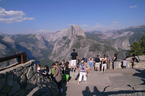
Half Dome vista from Glacier Point, with the recent rockslides (whitish patch) visible

After lunch on top with a couple hundred of our closest friends, we continued on the Panorama Trail, which offered amazing views of Half Dome, Tenaya Canyon, the Panorama Cliff, and the almost-dry Nevada and Vernal Falls. One particularly neat aspect of this hike was how the trail provided nearly continuous, but still always changing, views of some of Yosemite's more prominent features. For example, we got to see Half Dome from so many angles, I almost think you see it better on this hike than you do when actually scaling the giant dome itself.


Heading down the scenic Panorama Trail


Half Dome - dead-on


Panorama Trail view


On the JMT above Nevada Falls


Nevada Falls, a little drier than last time we discussed it...


Mmmm... dinner.

8.02.2009

Back from the Northwest

Hi readers - time for an update! We just recently returned from a trip to the Great Pacific Northwest where we spent a fun-filled few days with Kate's family (parents, sibings, and nieces and nephews and all) and then did some exploring on our own to break up the long drive back. Yes, we drove up to Seattle, in part because we were bringing the dogs. And yes, I said dogs (plural) because in addition to Banjo we brought up the cute little puppy that Kate adopted down here for her sister's family (as they had been unsuccessful this year in a search for a small terrier-type breed from a rescue/shelter in the Seattle area). So our drive up was pretty much a straight through blast, complete with a comfortable night spent in the back of the Subaru at the Roseburg, OR Wal-Mart parking lot (the price is right!). Unfortunately my camera went on the fritz and died right at the beginning of this trip, so you'll have to make do with these pictures from the internets that I think represent our travels.

The puppy delivery went well and while it was very fun to have a well-behaved and adorably small puppy around the house for a week, we are happy to see Kate's sister (and especially her dog-loving niece) get to have a dog of their own now. We think that Clover (as she's now named) will miss Banjo a little more than vice-versa, especially given Banjo's sudden increase in toy protectiveness that coincided with the puppy's arrival. They did play quite nice together, and it was really a blast to watch the two of them rough-house around outside or play-fight over a stuffy-toy.

Little Clover, back when she was just "puppy."

The big family gathering was at a gorgeous house we all rented for the big group in Union, WA - right on the Hood Canal at the SE end of the Olympic peninsula. This gave us great access to some beautiful spots like Twanoh State Park - a charming Depression-era CCC park project right on the water and with some lovely rainforesty trails - and the Staircase area of Olympic National Park. Kate and I tackled the thigh-burning Mt. Ellinor hike one morning, with 2,500" of vertical in the last mile to the summit! I even shared a shady nook on the summit crags with a mountain goat as I ate lunch, but as it turns out these goats are not uncommon in Olympic these days and are even becoming a nuisance.

One of the neat CCC-built buildings at Twanoh SP
The view from atop Mt. Ellinor N to Mt. Washington Some of the ubiquitous Olympic NP mountain goats with whom I shared the summit (the photo is from the top of Ellinor, too)

Some of the highlights of the family portion of our trip were the delicious meals we all took turns making each night, the lovely view over the water from the house's deck each evening, making exciting waterside or rainforesty discoveries with the nieces and nephews, a fun-filled day jumping off inflatable floats and boats at a nearby freshwater lake, and of course some game-playing with the adults after bedtime.

When the time eventually came for us to disperse again, Kate, Banjo, and I headed North to drive around the Olympic Peninsula and see some of the other areas in the National Park. First stop was Hurricane Ridge, an incredibly scenic ~15 mile drive up into the hills from Port Angeles terminating in a gorgeous alpine playground with several short trails to choose from. Unfortunately dogs aren't allowed on any of them so Banjo had to wait in the car while we took in some of the scenery. That may have been a good thing, as we saw a bear (!) just munching on some grass in between some of the paved "near the visitor center" style trails there! Alas, no pictures of the bear.


Some representative pictures of Hurricane Ridge

After Hurricane Ridge our intent was to head to the coast and camp at Kalaloch, a section of the park that covers the coastline, but we arrived to find out that both the regular and "primitive" campgrounds were both full (on a Thursday). Who knew! We took a nice long walk on the wide, foggy Kalaloch beach and let Banjo romp around in glee. Watching our dog run around on the sand, happily sprinting from one intriguing scent to the next and back to us was definitely a highlight of the trip - marred only by the fact that about 5 minutes before our hike was done he somehow managed to find a dead seagull to roll around in before we could get him off of it. Yick. Dead-seagull-covered Banjo with about 15 hours of driving left to do in the next two days. Fortunately we had a bathroom nearby at the lodge and a spare towel, so the little guy was punished for his transgressions with an impromptu bath.


Kalaloch Beach and Rocks, the latter of which were mostly obscured by the fog while we were there, but the beach itself was beautiful and eerie.

That we were denied a campsite at Kalaloch turned out to be a blessing in disguise, as our Plan B was driving a little further down to the Quinault Rain Forest area of Olympic NP. Here we found a fantastic campground with some easy walk-in sites right along a creek and a stone's throw from a lakeshore with lots of privacy thanks to the rain-foresty surroundings. We cooked up a quick dinner, made some s'mores, and cozied up in the tent happy we weren't stuck amongst the hoardes of RVs at Kalaloch.

One of the waterfalls near our Falls Creek campsite in the Quinault Rainforest area

The next day we packed up early and headed south, destination: Crater Lake. After a lunch stop in Portland at Corbett's Fish House for some delicious fish tacos, we veered East off I-5 for some scenic driving over the Oregon Cascades and south towards Crater Lake. We arrived at the lake around sunset and after taking in a couple viewpoints we found out yet again that the campground was full here too (despite a ranger telling me on the phone the day before that "that campground almost never fills up). This time Plan B was another NF campground about 10 miles away, but in 3-4 miles on dirt fire roads. After a turning off onto the NF roads we saw a couple signs directing us to a campsite but those signs quickly stopped and we drove on through the forest wondering what we'd find. Eventually we saw a little spur with a small sign identifying it as "Huckleberry Hill" so we thought we'd try that. This road wasn't grated and quickly turned into a rocky tree-strewn 4x4 road that was just about as much as my Subaru could handle, with Kate helping to pull fallen trees just enough out of the way so I could drive past. But all's well that ends well and we made it to the top of "Huckleberry Hill" which afforded us a really nice viewpoint over towards the rim of Crater Lake and the surrounding area. Interestingly you can see where we ended up in the bottom left of this map from the NPS, and also Google seems to have the dirt roads identified too - we ended up at the end of the spur road in the little clearing shown here. A quick camp-stove dinner, another nice campfire and s'more s'mores were followed by a night filled with crystal clear stars in the sky and visits from the local deer population (which Banjo found some combination of interesting and frightening). Again, everything seemed to work out nicely for us.

After Huckleberry Hill we went back up to Crater Lake early in the morning to get our fill of hiking and sightseeing in before finishing the drive home. Crater Lake was pretty amazing - the water is incredibly blue, the thousand-foot walls down to the lake staggeringly steep and severe, and of course Wizard Island in the middle is so quintessentially volcanic it almost looks like a middle-schooler's baking soda and vinegar science fair project. Views are unique from every vantage point around the lake, making the hike around the rim particularly interesting. Also making that hike interesting was the necessary attention to not trip and fall a thousand feet down cliffs into the lake - it really is right on the rim for a significant portion of the trail, at least for the ~5 miles I hiked on it between the visitor center and the Watchman overlook.

(I'll add some pictures of Crater Lake later)

After circling the lake and taking in some more viewpoints and a couple short little hikes we continued south through Oregon and California, had lunch in the shadow of impressive Mt. Shasta, and made it back safe and sound!

All in all a great trip despite the lots of driving. A few good books on tape and good company in the passenger seat helps there. I'm glad we got to see family and some natural highlights of the Pacific Northwest in the same trip, but it's always good to be back home too. Hopefully my new camera will arrive soon so I can get back to photo-enhanced blogging. Kate, was there anything I forgot that's worth mentioning?

7.03.2009

Ten Lakes Backpacking Trip

Last weekend we joined two couples of friends through Kate's soccer team for a backpacking trip out of the Tuolumne Meadows area of Yosemite NP. Tuolumne is higher elevation than the more famous Yosemite Valley, and is more known for its open high-country peaks and mountain passes and lakes (as opposed to the quintessential valley with all the waterfalls and domes). Kate and I went up early Friday with Bill and did a day-hike to Cathedral Lakes, right below spectacularly jagged Cathedral Peak. We had to brave a swampy meadow teeming with mosquitos to get out to the lake, but as you can see, the views from out there made it worthwhile.


Mosquitos! Run!


Hiking along the shores of Cathedral Lake


Looking back over Cathedral Lake at Cathedral Peak

That night we were joined by three others (Roe, Igor, and Petra) at the campground after happily making s'mores and watching the stars around the fire left by the nightly ranger talk. Even later, our little corner of the backpacker's campground was paid a visit by a pretty tame bear who was curious enough about the contents of one of our neighbor's backpacks to loudly eviscerate it (the backpack, not the neighbor) at 3am maybe 15 feet from my head. I guess he was after an overlooked packet of Crystal Light or something. Fortunately the backpack owners got up and scared the furry beast off, then we put their packs into one of the metal food storage lockers. Good thing too, because he (the bear) came back around dawn and sniffed around again at the very locker where their packs were.

The next morning we got on the trail to Ten Lakes, a cluster of seven (yeah, I know! not ten - weird) alpine lakes north of the main road through Yosemite. This being the introduction to backpacking for a couple of the other folks with us it wasn't too strenuous of an adventure - maybe 6-7 miles in - but it was a nice trail and offered some great vistas upon reaching Ten Lakes pass.

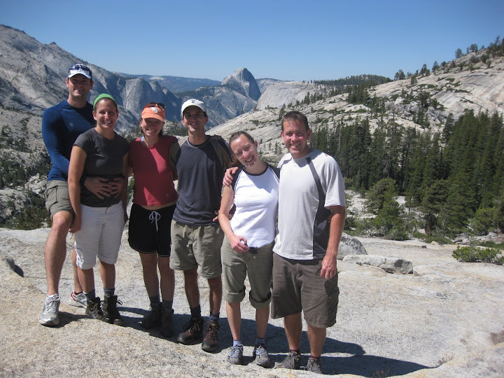
Our group at Olmstead Point before starting our hike


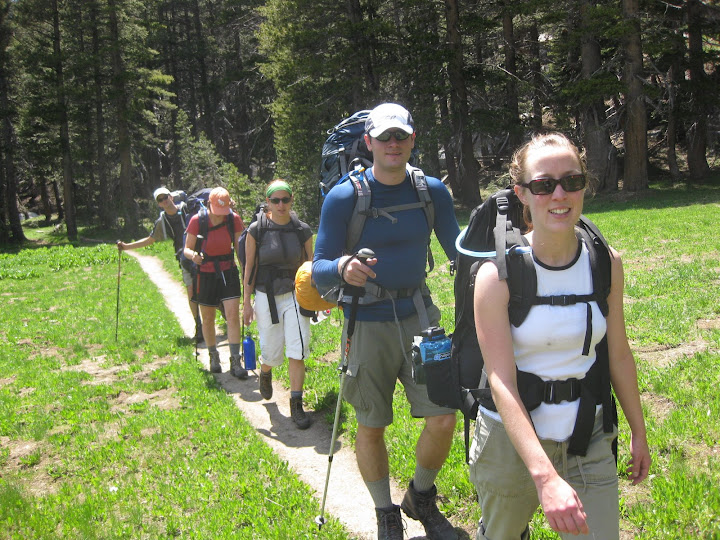
On the trail: Kate, Roe, Petra, Igor

Hiking through the meadow: Tom, Kate, Roe, Igor, Petra


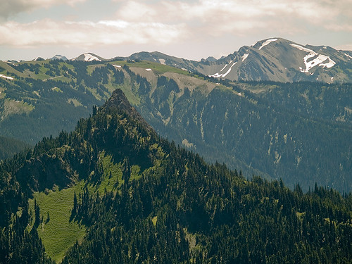
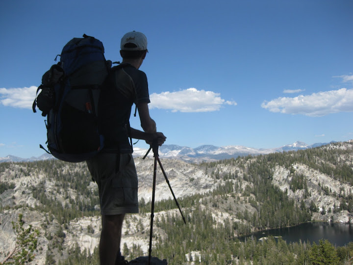
The view from the pass NE towards North Pk, Conness, White Mt.

On the steep drop down into Ten Lakes Basin


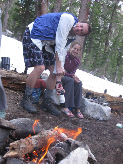
We found an amazing lake-front campsite a little ways off the trail and spent the afternoon swimming (brrrrr!), exploring the other lakes and streams, pumping water, collecting wood for a fire, eating smoked salmon, and drinking wine. What? You guys don't eat smoked salmon and uncork a nice bottle of Cabernet on your backpacking trips? I guess you need to go with Roe and Igor and Bill and Petra more often. The wine (packed in by the other boys, I must confess) was a nice touch as Kate and I were actually celebrating our 1000th day of being married to each other, a nice milestone I took note of in an imitation of my Uncle Larry, who has celebrated both his 1,000th and more recently 10,000th days of marriage to Aunt Carol! Thanks for the idea, Toledos.


Our campsite by the lake


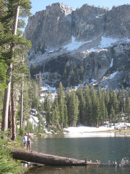
Nothing beats a good swimming spot after a day of hiking in the sun.


The lakeside view


Petra and Bill make pancakes! We ate pretty gourmet this trip...


Igor celebrates going downhill on the way out

After our hike out we went down to the valley to take in some of the sights and swim in the Merced River, which was refreshingly almost as cold as the alpine lake the day before! Brrrr... Anyways, a good trip and scenic location - always nice to take advantage of some of the beautiful country we have in our extended backyard out here in California.

Here are the photos I took, and there are some others by Bill here if you're curious.

Happy Independence Day!